

By Sandeep Sharma
GUWAHATI, OCT 6: A five-year GPS telemetry study by the Assam Forest Department and WWF-India has mapped the seasonal movement of wild elephants across forests, tea gardens, farmlands and riverine areas, throwing up vital clues to their habitat use and conflict with people.
The study, conducted between 2021 and 2026, tracked four female-led herds and a solitary male in Udalguri, Sonitpur and Biswanath districts. More than 38,000 GPS locations were recorded, providing a detailed picture of elephant movements across Assam’s increasingly fragmented landscape.
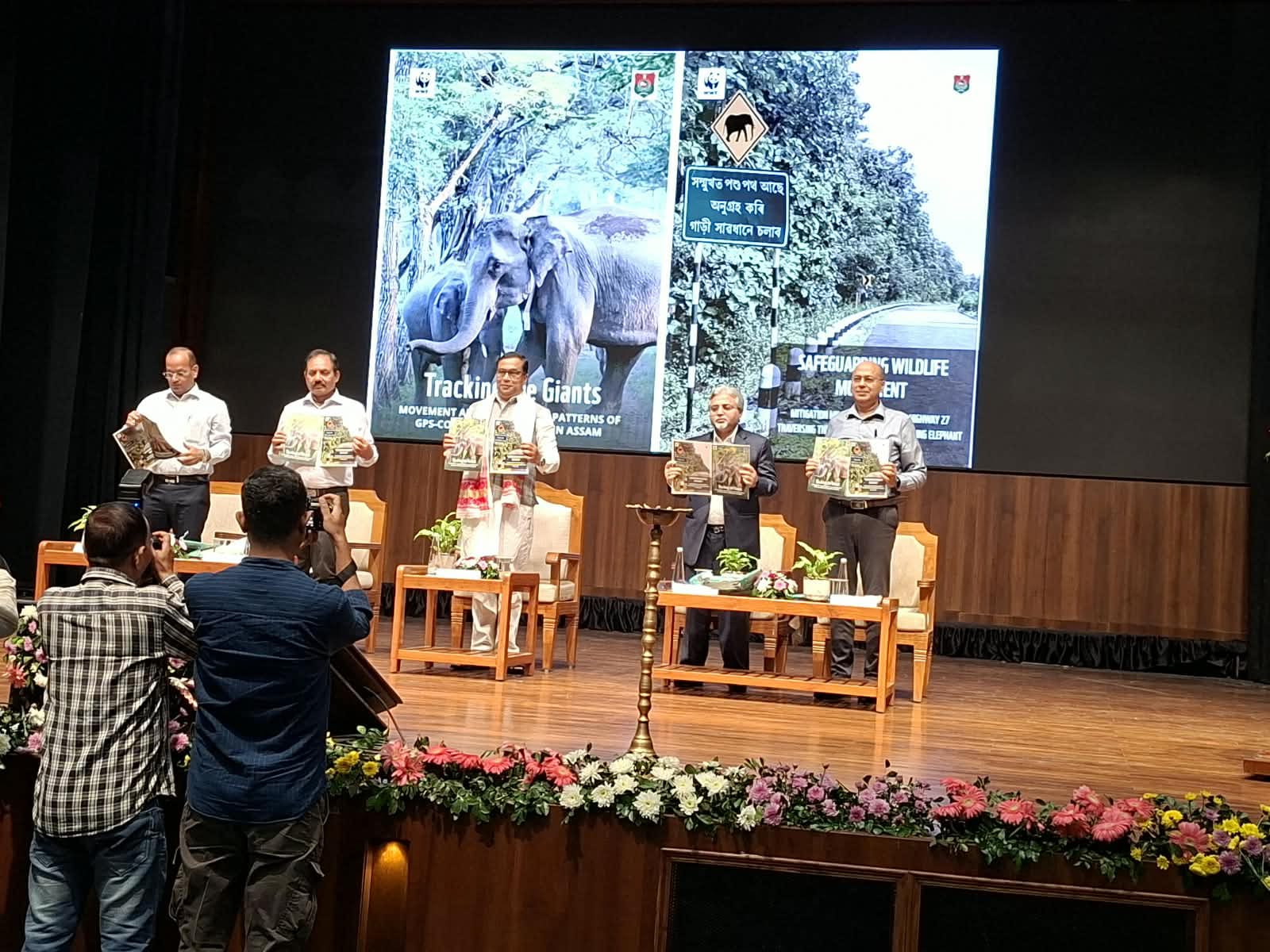
The findings are contained in a report, Tracking the Giants: Movement and Habitat-Use Patterns of GPS-Collared Elephants in Assam, released by Environment and Forest Minister Jayanta Mallabaruah at the 72nd Wildlife Week event in Guwahati on Tuesday.
Assam remains a major stronghold of the Asian elephant, but shrinking and degraded habitats have increasingly pushed elephants into human-dominated areas, leading to crop and property damage, human casualties and elephant deaths.
Vinay Gupta, Principal Chief Conservator of Forests-Wildlife and Chief Wildlife Warden, said the study filled a major gap in knowledge about elephant presence and movement in the State.
The data, he said, provided a baseline for understanding elephant ranging patterns, particularly where their movements overlap with human land use, and would help strengthen conservation and human-elephant coexistence measures.
Aritra Kshettry, who leads WWF-India’s Elephant Conservation Programme, said the telemetry study had identified core natural and secondary habitats as well as clear seasonal shifts in elephant movement.
He said the findings would help authorities better understand where elephants move, how they use different landscapes and how their movements change with seasons — information crucial for managing human-elephant conflict and protecting key habitats and corridors.
Tea gardens emerge as key elephant routesThe study found that Sonai Rupai Wildlife Sanctuary, Behali Wildlife Sanctuary and Bornadi Wildlife Sanctuary were among the most important habitats used by the collared elephants.
Tea gardens also emerged as significant movement routes and secondary habitats, frequently bringing elephants into close proximity to people. Protected areas and reserve forests remained the mainstay of elephant habitat for much of the year.
The home ranges of female-led herds expanded during the paddy cultivation season, coinciding with a sharp rise in human-elephant conflict.
An important finding was the use of river channels by elephants to move north-south between forests along the Himalayan foothills and the grasslands, or chaporis, of the Brahmaputra.
The study also found several elephant routes cutting across roads, railway lines and human settlements, highlighting the need for targeted safeguards to prevent human casualties and elephant deaths.
Elephants cross into Bhutan
The GPS data also captured transboundary movement between Udalguri and Bhutan’s adjoining Jomotsangkha Wildlife Sanctuary during the dry season.
The finding underlines the need for closer coordination between India and Bhutan to protect elephant corridors that cut across the international boundary.
The report is expected to strengthen landscape-level conservation planning, help authorities identify conflict-prone areas and support measures aimed at securing elephant corridors while reducing risks to communities living alongside them.












Leave a Reply